Home Products Services Demo Contact Get a Quote

Hardware

FJD Trion

A single modular scanner that adapts to every environment — handheld, drone-mounted, robot-deployed, or on a stabilised backpack.

FJD Trion scanner showing all modules

Overview

Modular by Design

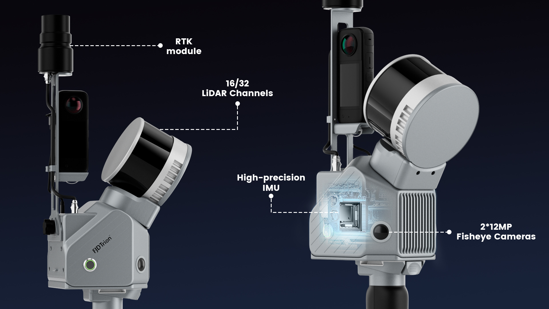
The FJD Trion combines a 16 or 32-channel LiDAR sensor with dual 12MP fisheye cameras and a high-precision IMU into a compact, field-hardened unit. An optional RTK module adds GNSS-based absolute georeferencing when needed.

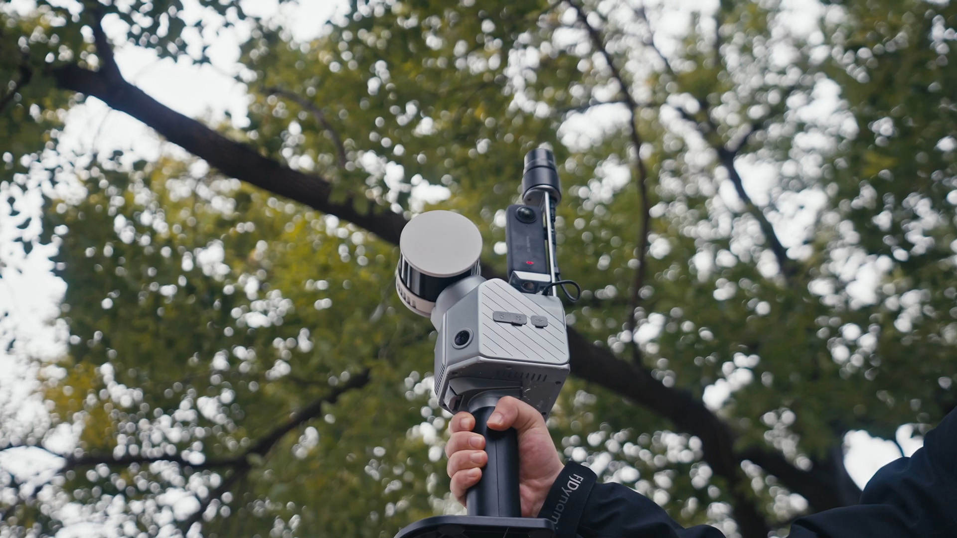
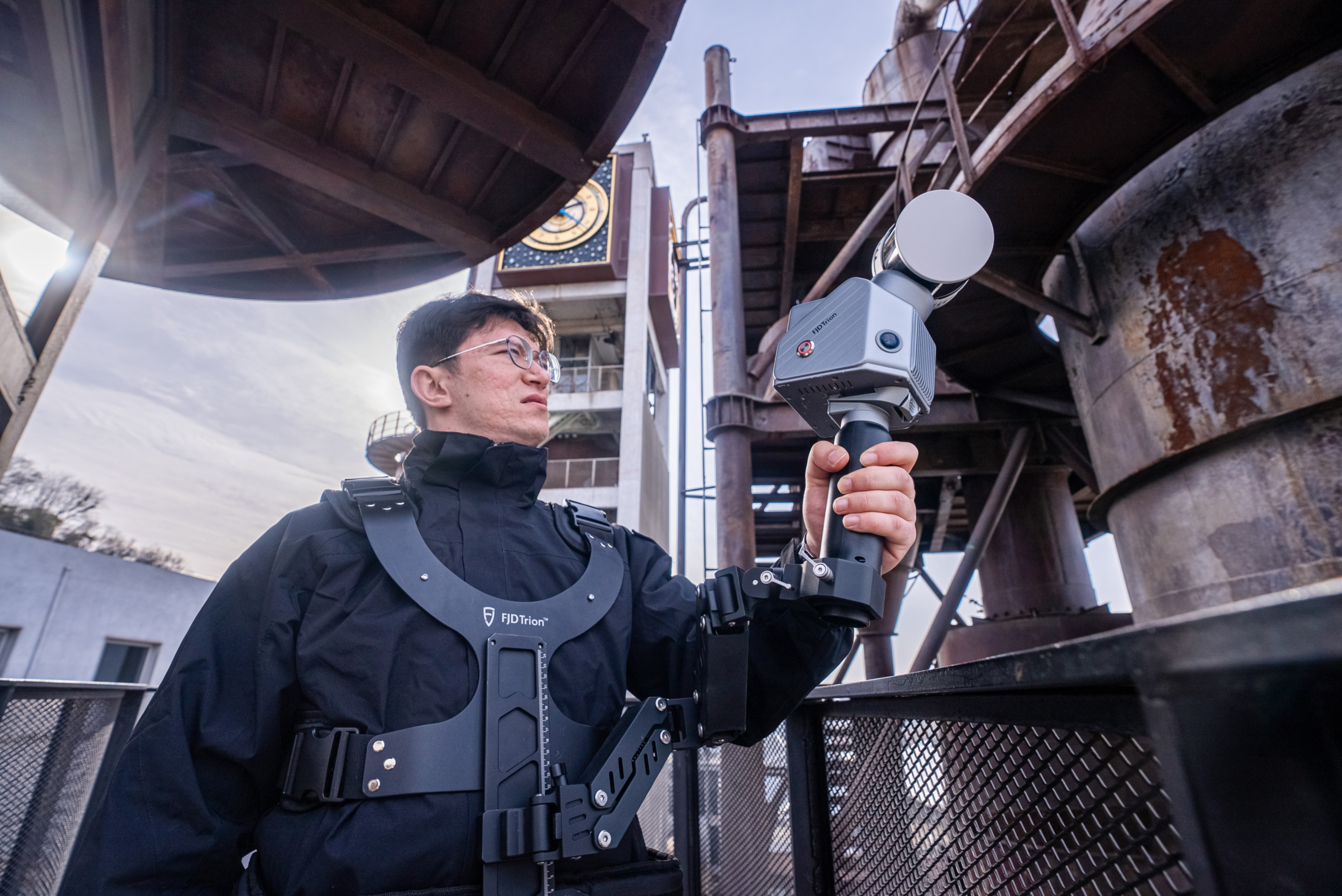
Whether you're walking a construction site, flying a drone over open terrain, or inspecting an underground tunnel on a robot, the same scanner, the same software, and the same data pipeline.

LiDAR Channels16 / 32 (configurable)
Cameras2 × 12MP Fisheye
IMUHigh-Precision (MEMS)
GNSS / RTKOptional add-on module
SLAM ModesLiDAR SLAM + Visual-Inertial Odometry
PPKSupported
RangeUp to 100 m
Relative Accuracy±2 cm (typical)
Point Cloud OutputColourised LAS / PLY / E57
Request Pricing Arrange a Demo

Key Technologies

What Sets It Apart

01 — Hardware

Multi-Module Integration

The Trion's modular architecture lets you configure the scanner for each project. Attach the RTK module for outdoor geo-referencing, remove it for GPS-denied indoor environments to save weight.

  • 16/32 LiDAR Channels — choose point density to suit your accuracy needs and battery constraints
  • 2 × 12MP Fisheye — full 360° colour capture for true-colour point clouds
  • RTK Module — optional snap-on for survey-grade absolute positioning
Multi-module integration diagram

02 — Algorithms

Multi-SLAM Algorithms

Two SLAM algorithms run in parallel: LiDAR SLAM for feature-rich environments and Visual-Inertial Odometry for featureless or GNSS-denied spaces. The system automatically fuses both to maintain trajectory accuracy through every condition.

  • LiDAR SLAM — geometry-based loop closure in structured outdoor and indoor scenes
  • Visual-Inertial Odometry — camera + IMU fusion for dark, low-structure, or underground areas
  • Automatic fusion — no manual mode switching required in the field
Multi-SLAM — VIO vs LiDAR SLAM comparison

03 — Georeferencing

PPK Support

Post-Processing Kinematic correction enables survey-grade absolute accuracy without requiring a live RTK correction stream during capture. Return to the office, apply base-station data, and achieve centimetre-level georeferencing.

  • No live connection needed — scan freely, correct in post
  • Centimetre absolute accuracy — suitable for survey and mapping deliverables
  • Works with any CORS network — use existing base station infrastructure
FJD Trion with RTK module in field use

Deployment

Five Ways to Deploy

Every carrier uses the same mounting interface. Switch platforms in the field in under a minute.

Extension pole
Extension Pole
Handheld / elevated capture
Stabilising vest
Stabilising Vest
Hands-free mobile scanning
Drone mount
Drone Mount
Aerial LiDAR survey
Robot dog
Robot Dog (Edog)
Autonomous hazardous access
Rolling suitcase
Rolling Suitcase
Rapid indoor corridor mapping

All-in-One Workflow

Collect. Process. Deliver.

The FJD ecosystem covers every stage — from field capture through to client-ready deliverables, all within one software platform.

1 — Data Collection
Walk, fly, or drive. The Trion captures dense colourised point clouds in real time with on-device SLAM processing. Preview your scan before leaving the site.
2 — Data Processing
Import to the companion software for registration, noise filtering, classification, and georeferencing. Apply PPK corrections and export in any standard format.
3 — Collaborate & Deliver
Share point clouds, create measurements, mark annotations, and deliver to clients via secure cloud links — no specialist viewer software required.

Enquire About the FJD Trion

Pricing, availability, demo units, and trade-in options — get in touch and we'll respond within one business day.