What We Do
Services
Every service is delivered using FJD Trion equipment operated by our certified team.
LiDAR Scanning
Field scanning using handheld, drone, and robot-deployed Trion systems. We cover indoor, outdoor, underground, and access-restricted environments. Same-day point cloud preview on site.
Point Cloud Processing
Registration, noise filtering, ground/structure/vegetation classification, and georeferencing. We accept raw data from the FJD Trion and most other major scanner platforms. Standard 48-hour turnaround.
Aerial Survey & Mapping
Drone-mounted Trion for topographic survey, stockpile volumes, corridor mapping, and large-area point cloud capture. DTM, DSM, orthophoto, and contour deliverables.

As-Built Documentation
Accurate 2D drawings — floor plans, elevations, and sections — extracted directly from point cloud data. Suitable for renovation, compliance, and facilities management. DWG, DXF, PDF delivery.
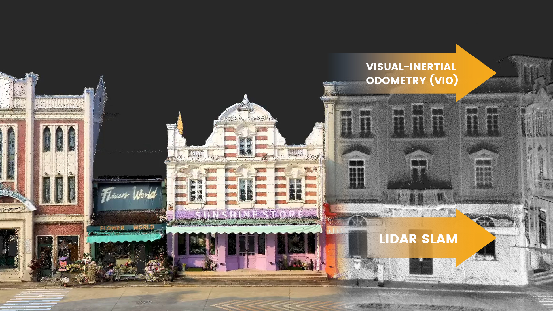
Underground & Confined Space
GNSS-denied environments are where the Trion's multi-SLAM approach excels. Mines, tunnels, plant rooms, and data centres — anywhere conventional total stations can't reach efficiently.
BIM & CAD Integration
Scan-to-BIM at LOD 200–400 in Revit, ArchiCAD, and AutoCAD. MEP and structural content. IFC / RVT / NWD export. Every model verified against the point cloud at ±3mm.